


Rio 2016 Bid - Barra Cluster
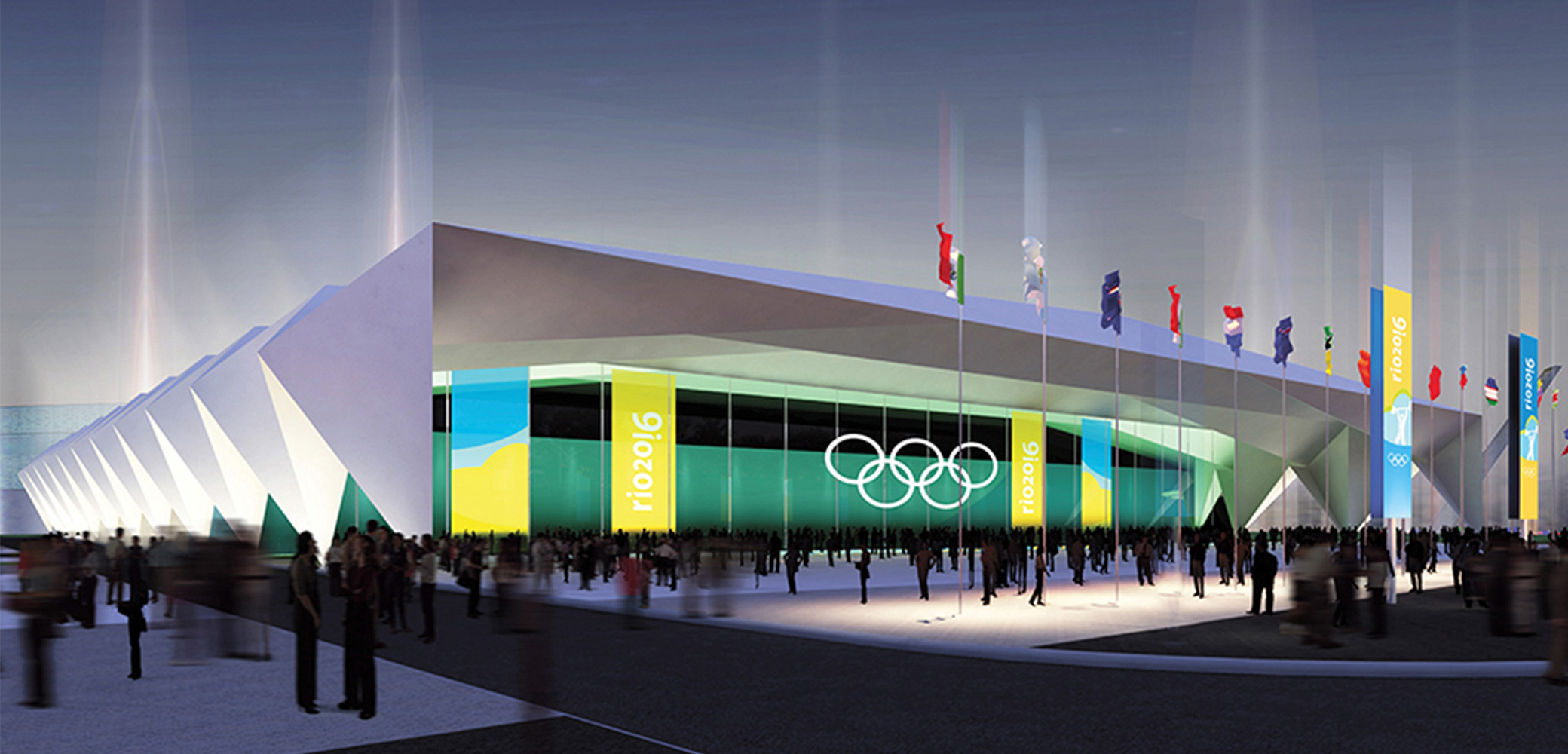
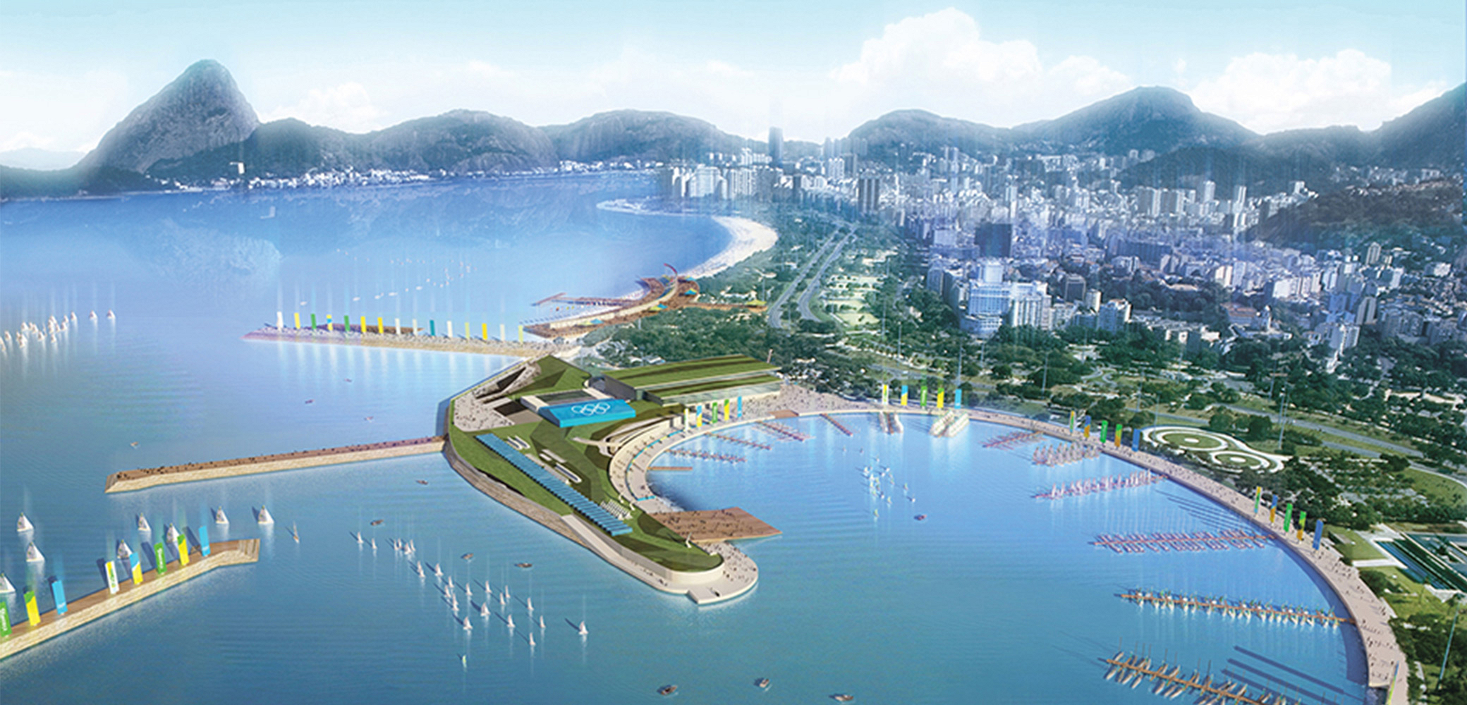
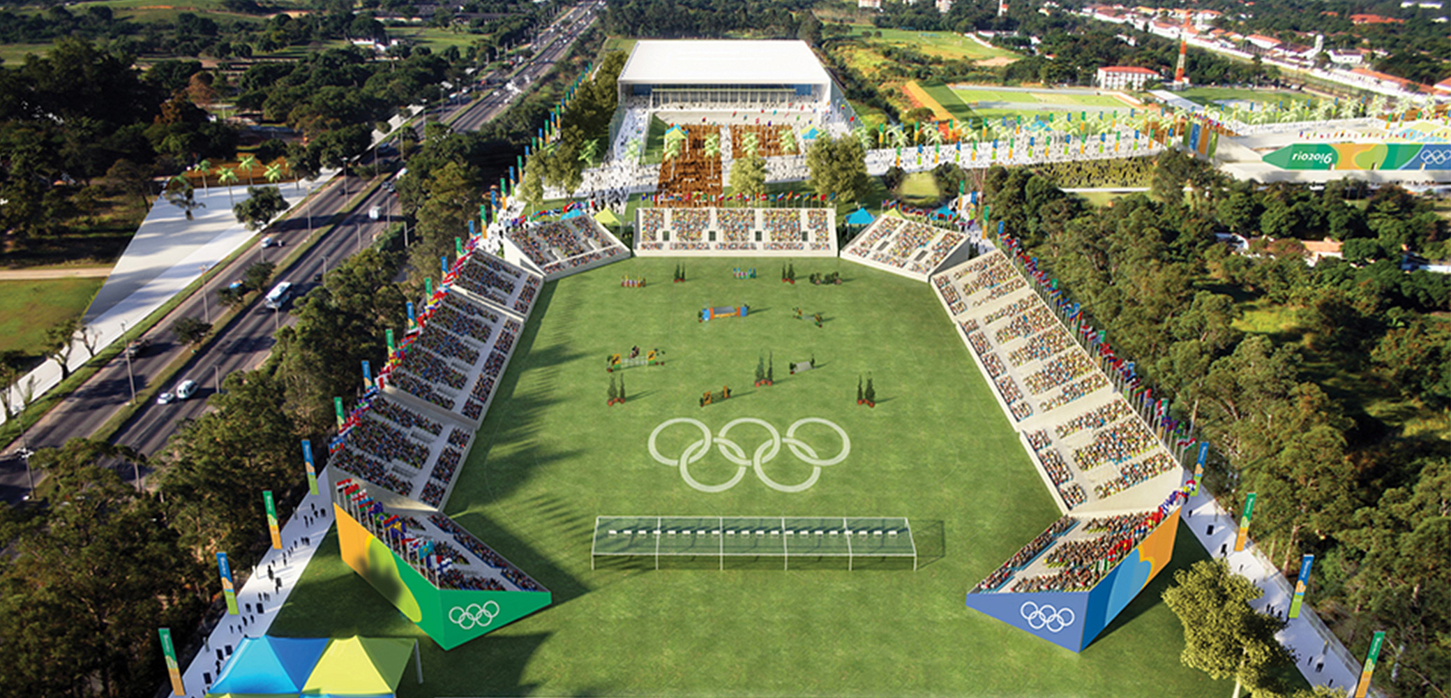
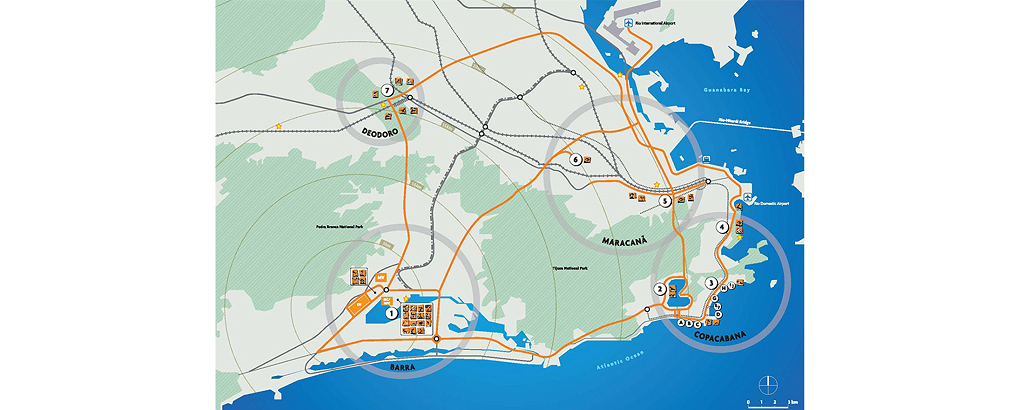
Rio de Janeiro, RJ, Brazil 2008-2009The practice was responsible for the preliminary studies (architecture and landscape design) of most of the new venues and facilities to be built for the Olympic Games, working closely with the Rio 2016 Organizing Committee team and its international consultants EKS/JBD (responsible for the Games Overlay and Operational Planning), in accordance with their briefings and pre-requisites. BCMF acted as the lead designer of 17 new venues and facilities, as well as the complementation of 3 existing ones, located mainly in the Barra da Tijuca and Deodoro clusters — where the architects had previously designed the Deodoro Sports Complex for the Rio 2007 Pan-American Games. In addition, the practice also provided design support to the Rio 2016 team in the development of temporary structures and was responsible for producing most of the imagery for the Olympic Dossier. As pre-defined by the COB (Brazilian Olympic Committee), the facilities for the Rio 2016 Olympic Games were grouped into four major and distinct areas of the city, interconnected by an efficient transportation system: Barra da Tijuca, Copacabana, Maracanã, and Deodoro. This strategy was intended to distribute the direct and indirect benefits of the Games among all the inhabitants of Rio de Janeiro, through the construction of new facilities and infrastructure, as well as improvements to the existing network. While the Copacabana cluster would primarily host temporary structures, the Maracanã and Deodoro clusters would have their existing venues complemented, and Barra da Tijuca would concentrate the majority of the new venues and facilities to be built or adapted.


BARRA CLUSTER
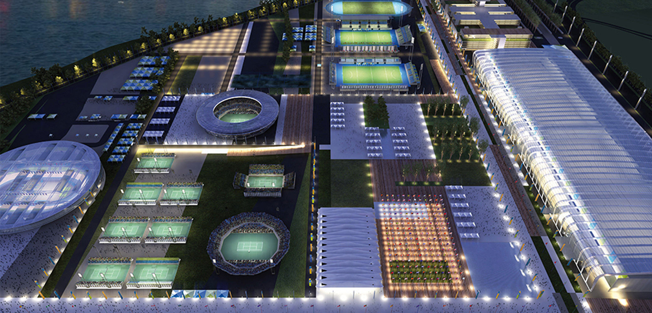
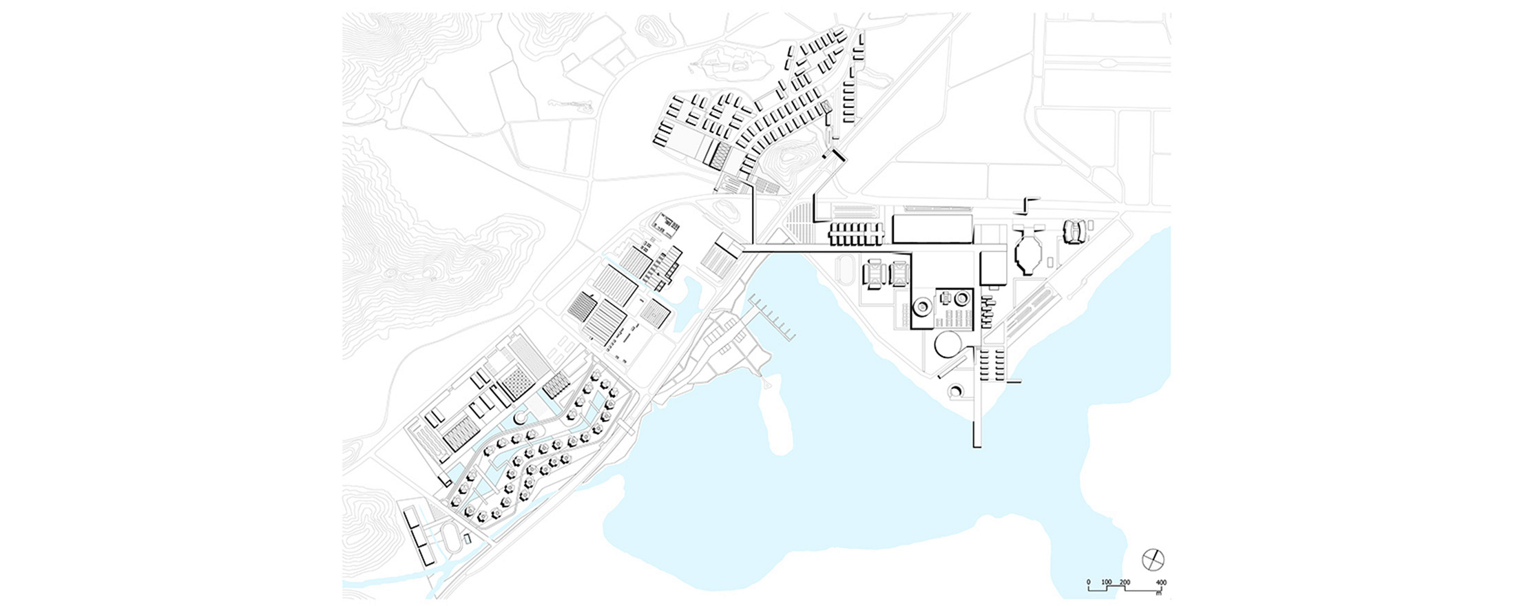
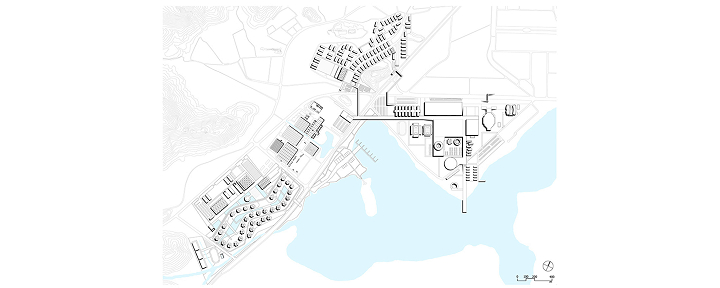
Rio Olympic Park (OLP): “3D Landscape Design”
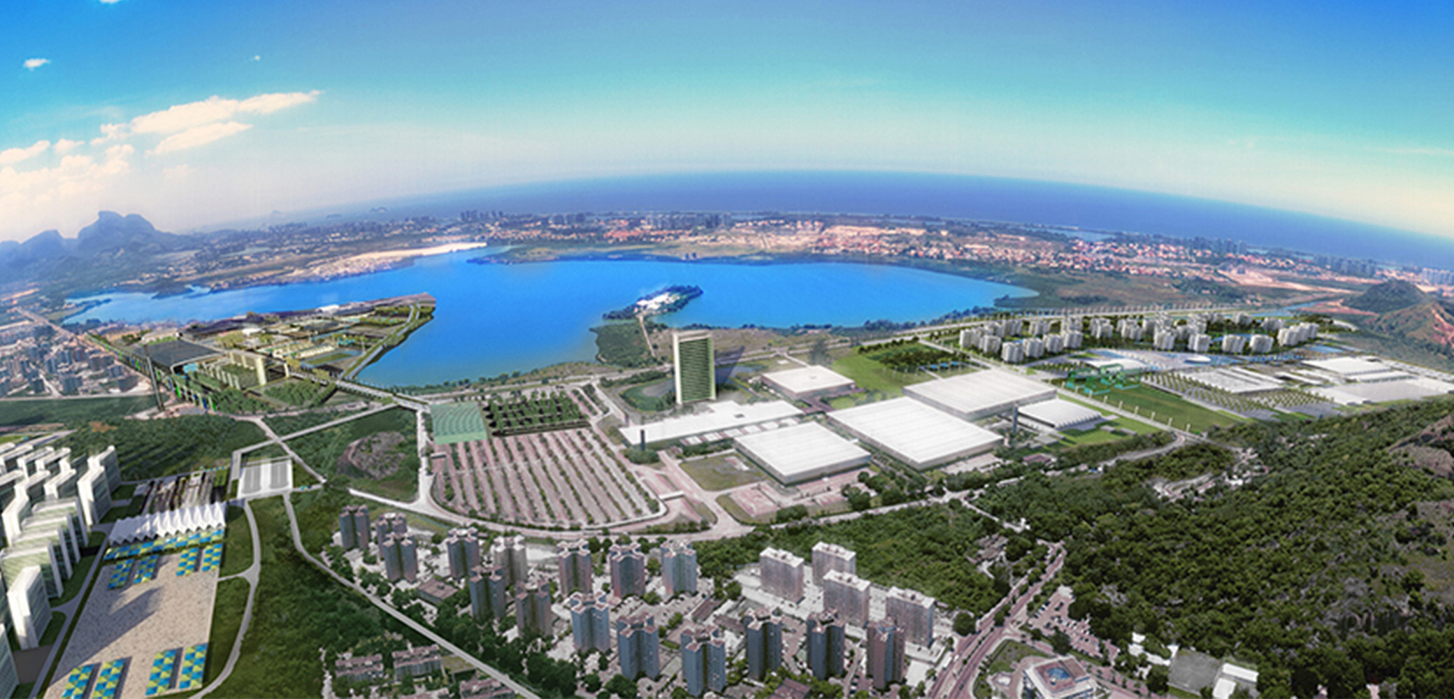
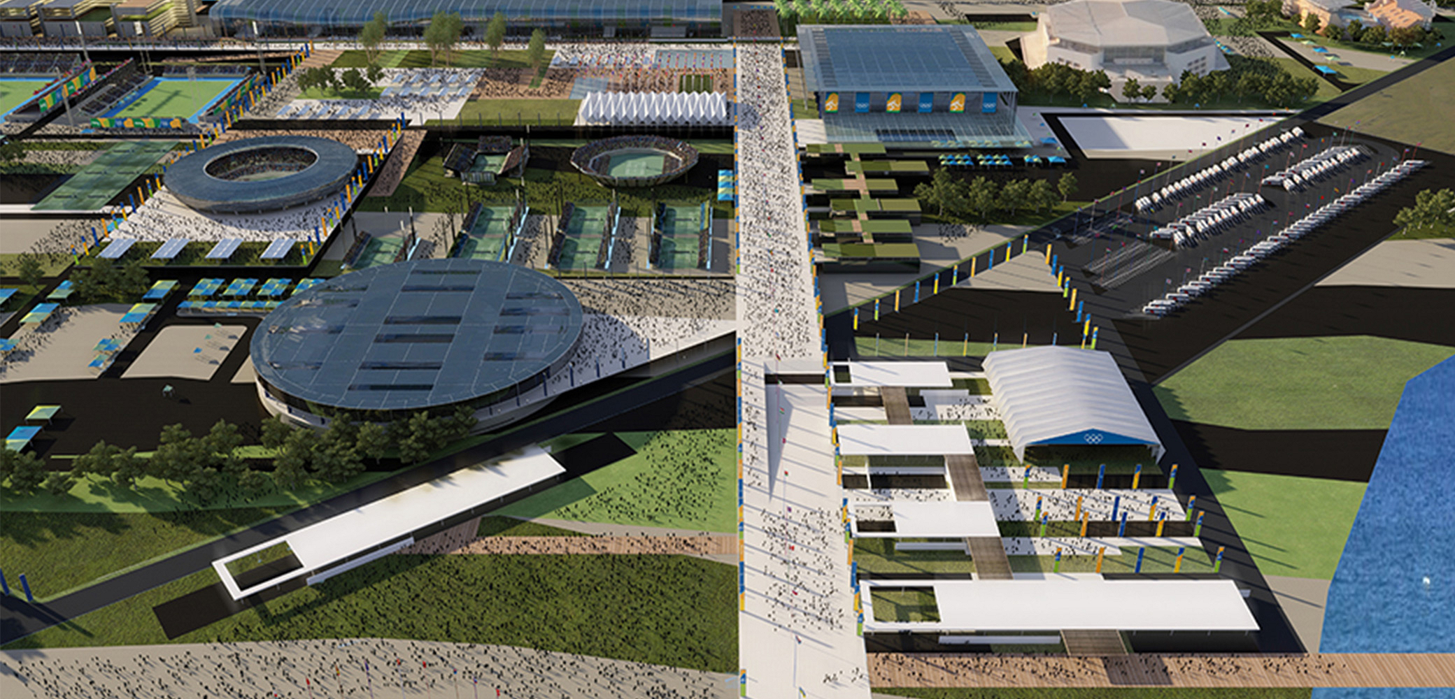
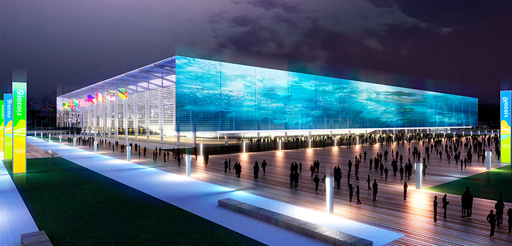
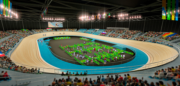
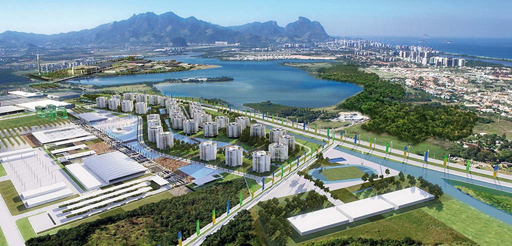
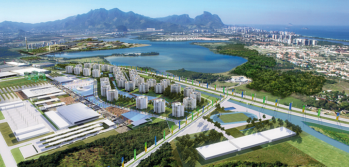
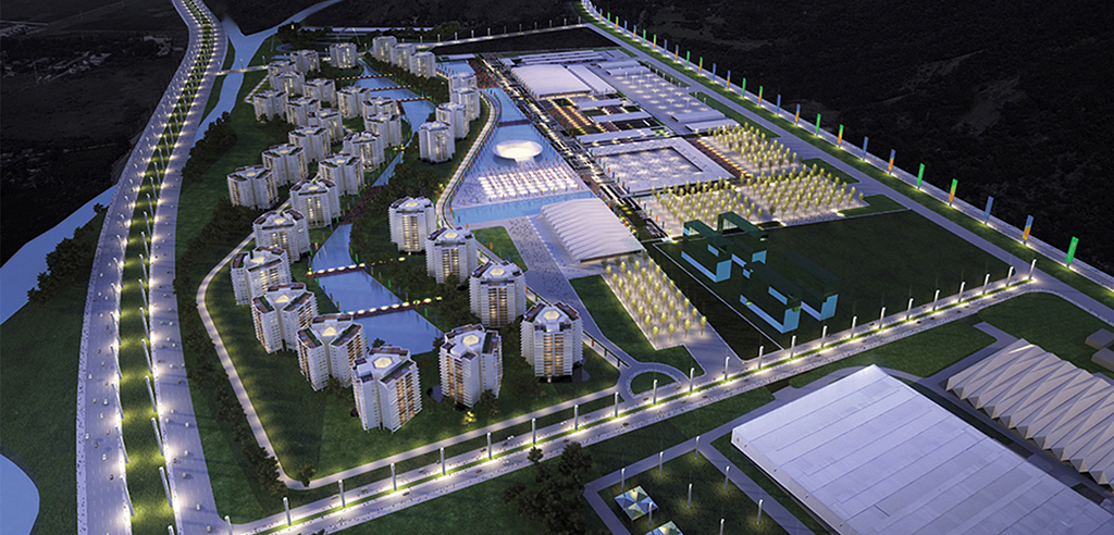
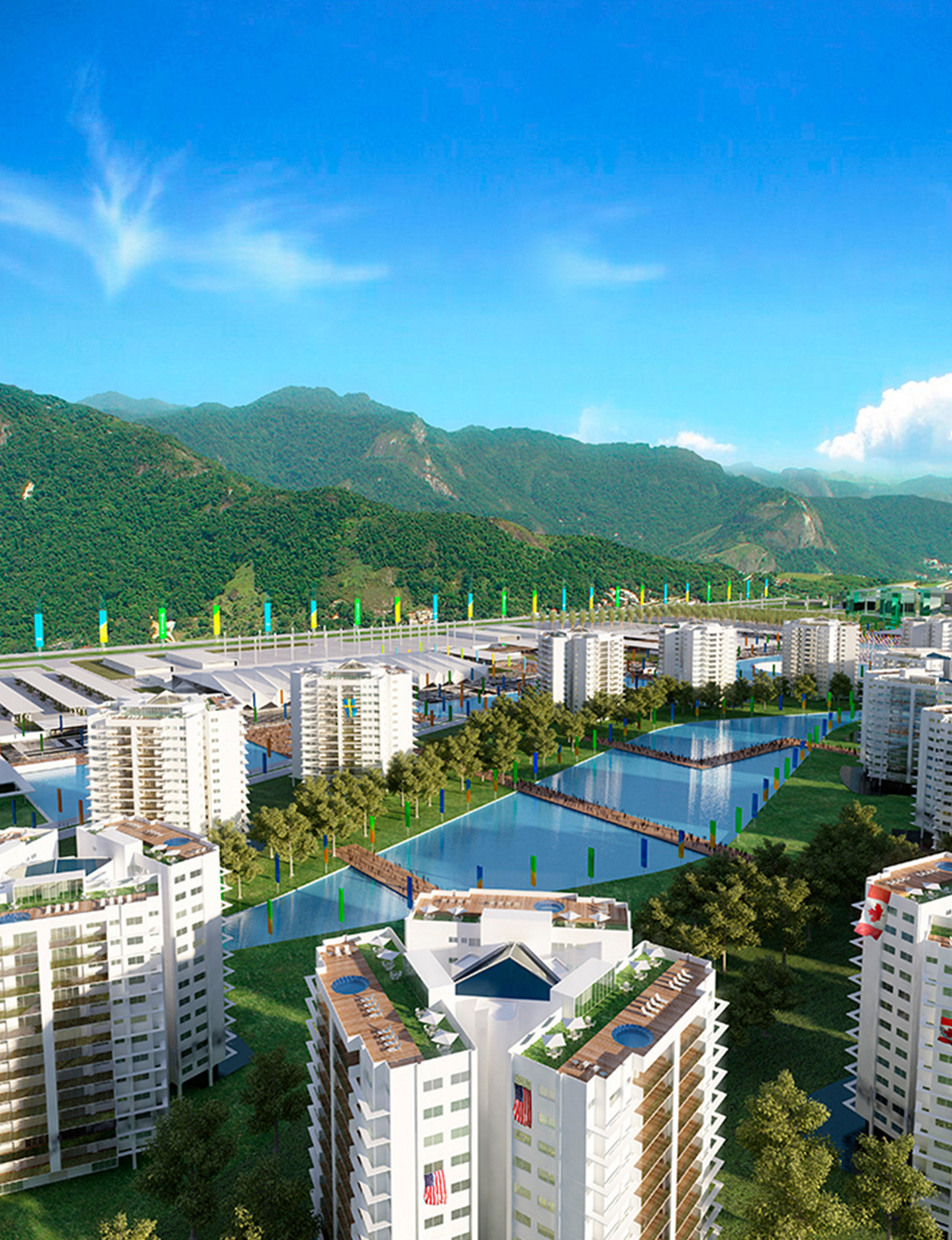
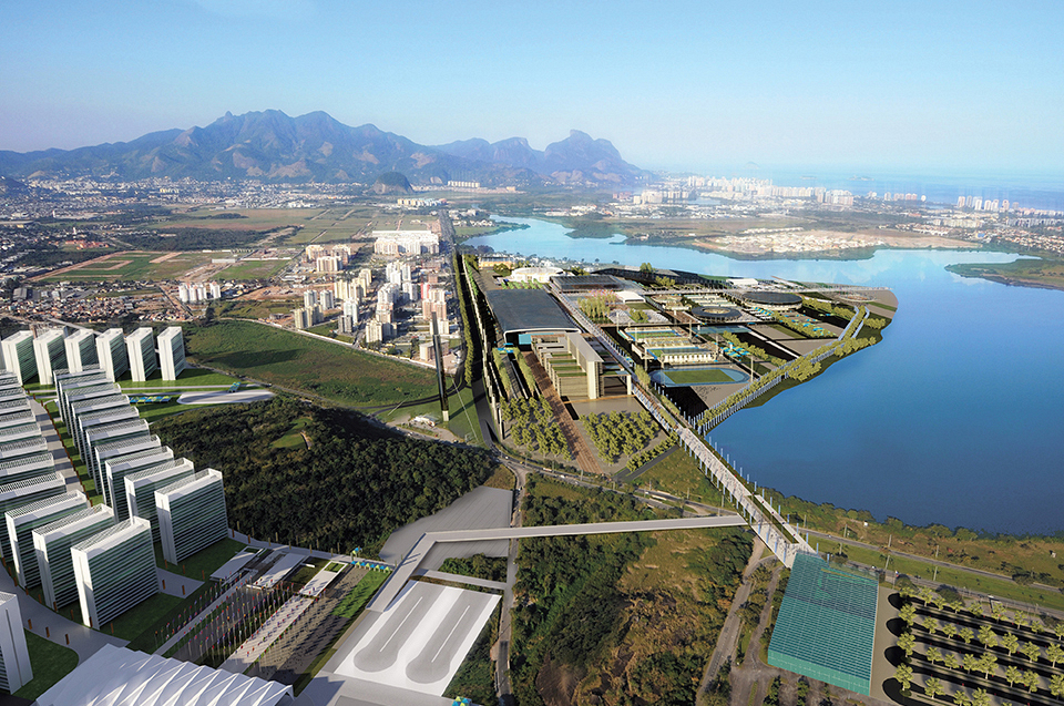
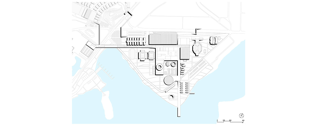
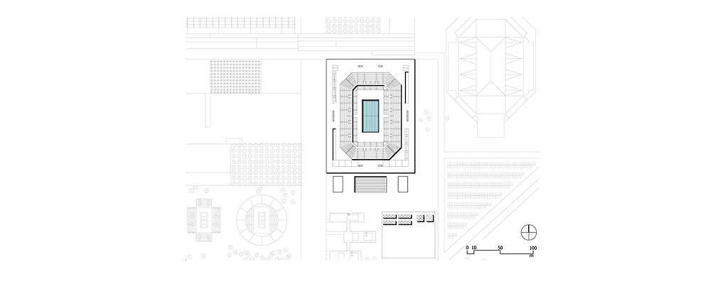
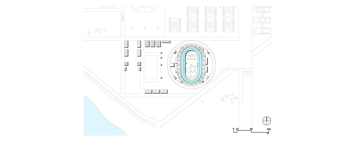
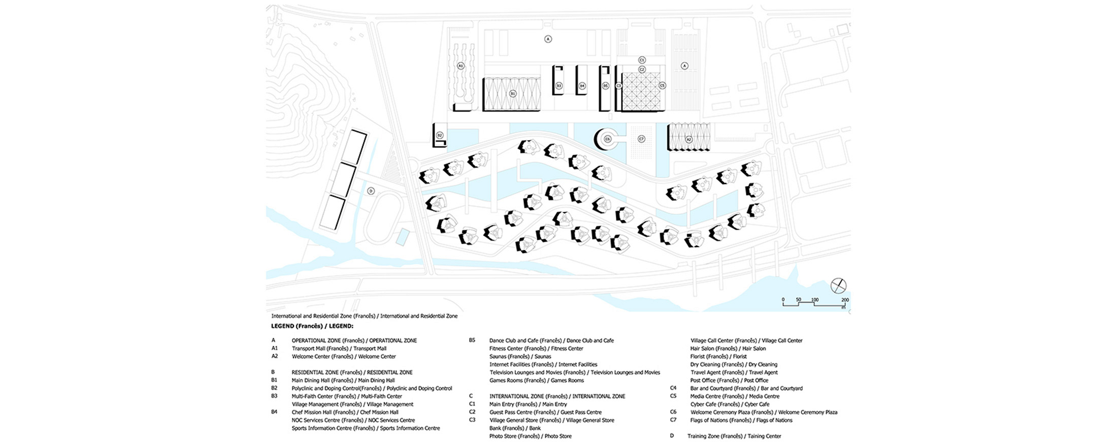
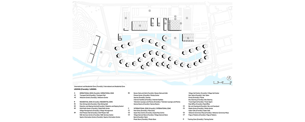
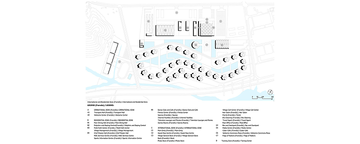
The Rio Olympic Park (OLP) was planned on a triangular site of approximately 1,000,000 m², with a privileged location in Barra da Tijuca, along the edges of the Marapendi Lagoon, and with its base aligned to Avenida Abelardo Bueno. The site currently hosts the Jacarepaguá Racetrack, as well as the Olympic Arena (ROA), the Maria Lenk Aquatic Center (AQC), and the Rio Olympic Velodrome (ROV) — facilities originally built for the 2007 Pan-American Games.
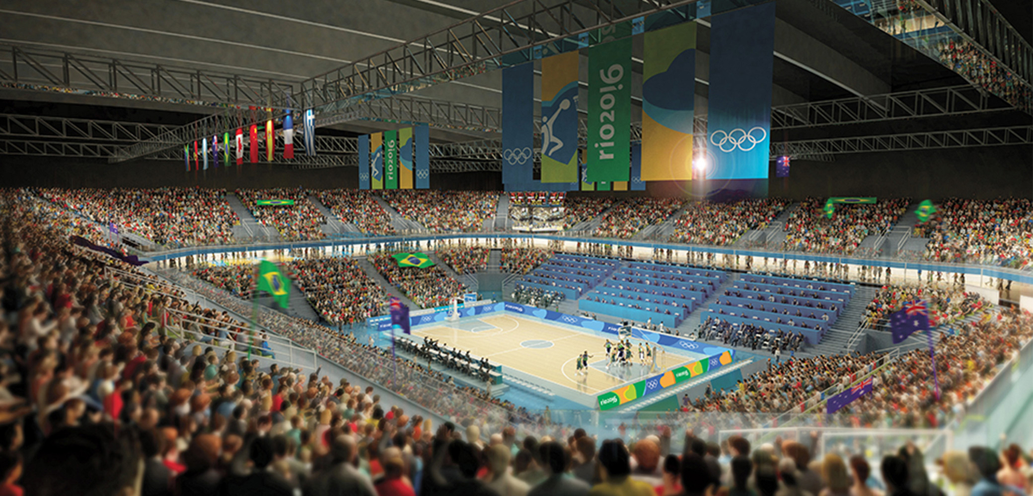
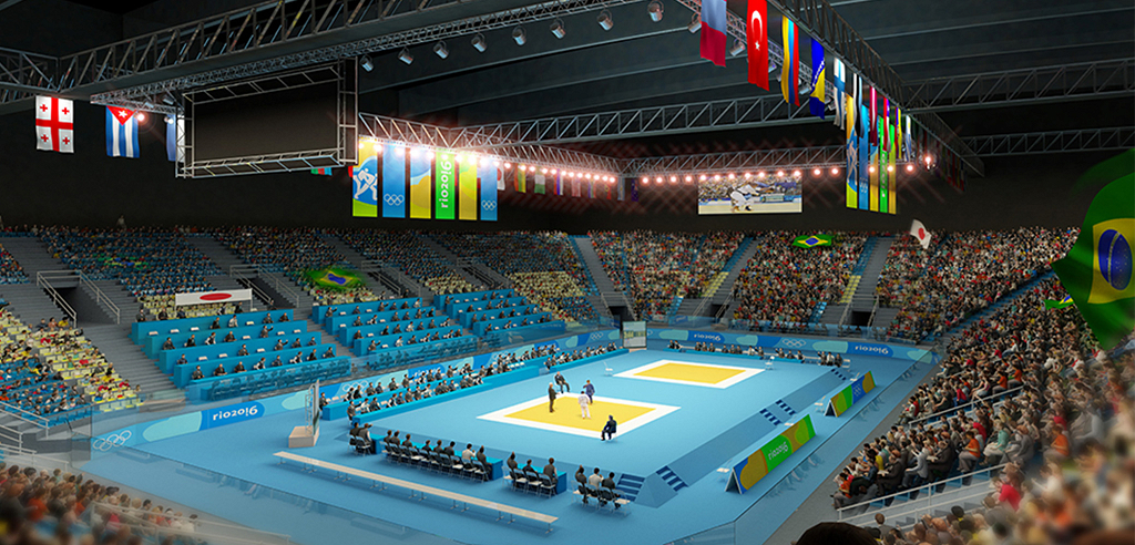
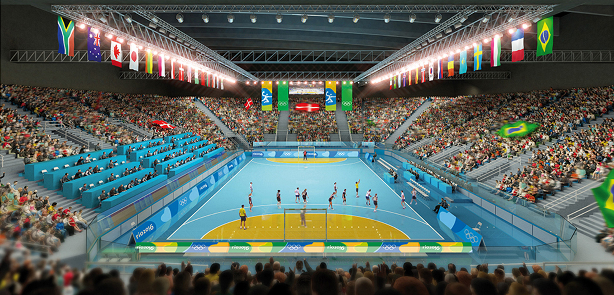
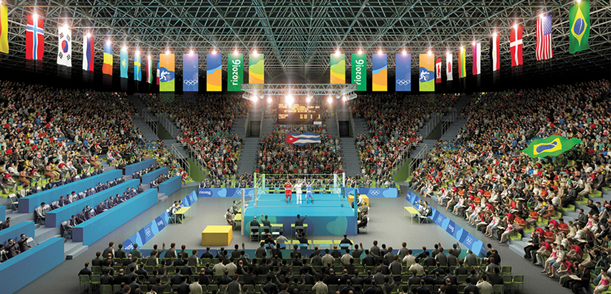
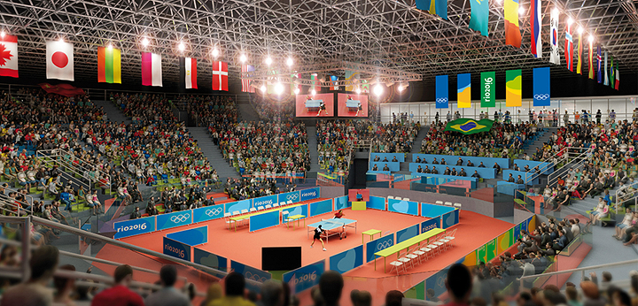
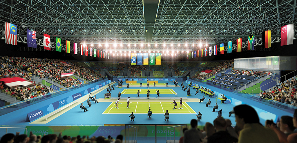
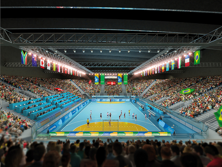
The Olympic Park (OLP) will concentrate venues and support facilities for 13 different sports disciplines and is intended to evolve into a high-performance training and research center, serving athletes not only from Brazil but from all of Latin America, becoming one of the main legacies of the Games.
The Masterplan concept treats the site as a “Campus” or “Park”, where the various venues are connected and integrated through an intensive landscape strategy, developed across all levels. Conceptually, the design strategy addressed three fundamental questions:
-
How to resolve the sectorization and separation of different flows — especially between accredited users (BOH) and the paying public (FOH) — within the security perimeter, ensuring controlled access, functionality, space for the full programmatic requirements of each venue, and the desired “void” around the buildings?
-
How to connect the different venues, creating a thematic Sports and Training Park that would remain viable as a post-Olympic legacy, functioning simultaneously as a new open public space and a controlled, high-level training center?
-
How to relate this hybrid park to the natural and urban landscape of Barra da Tijuca, a rapidly expanding area of Rio de Janeiro characterized by wide high-speed avenues, large shopping centers, gated residential developments, and a scarcity of traditional public spaces and pedestrian-oriented urban life?
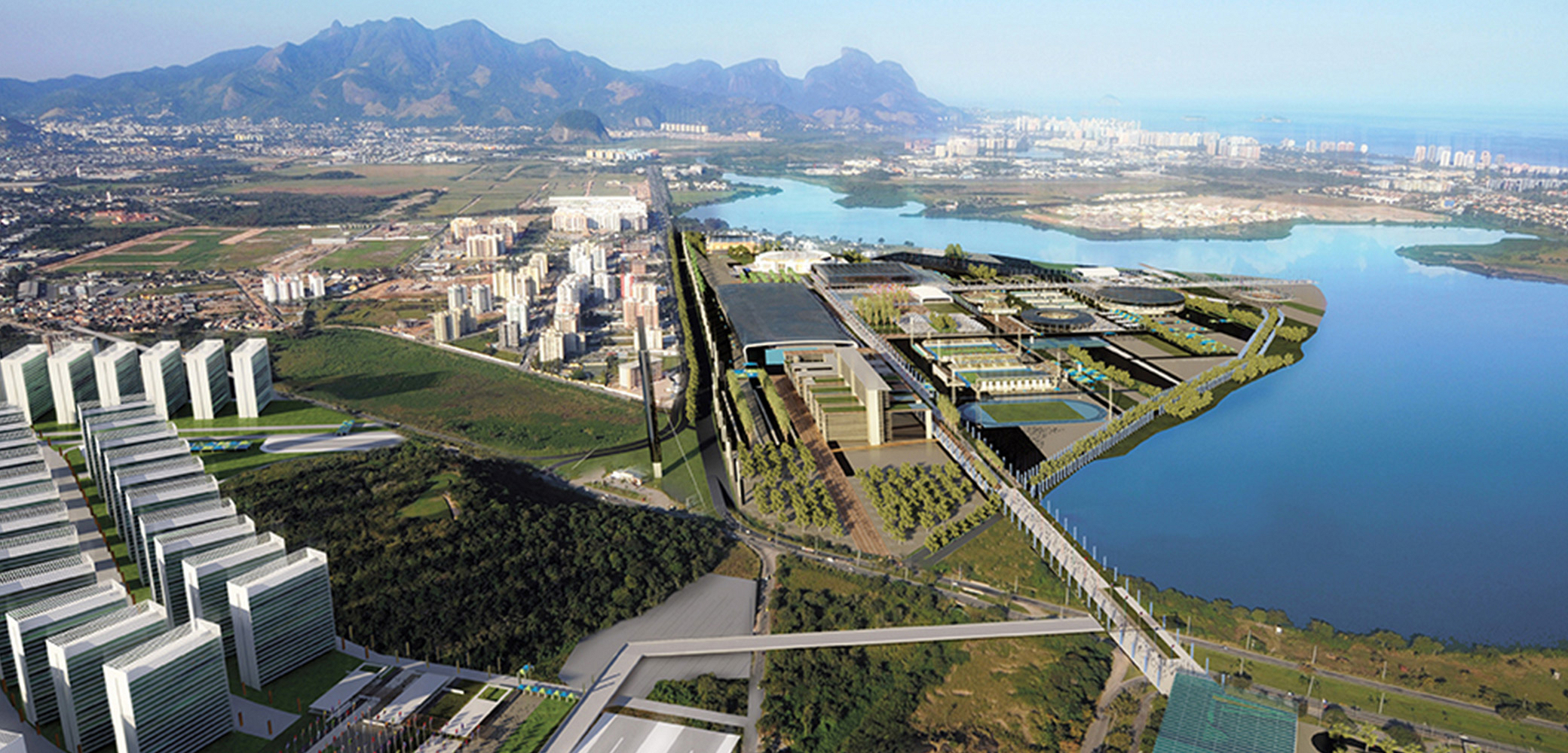
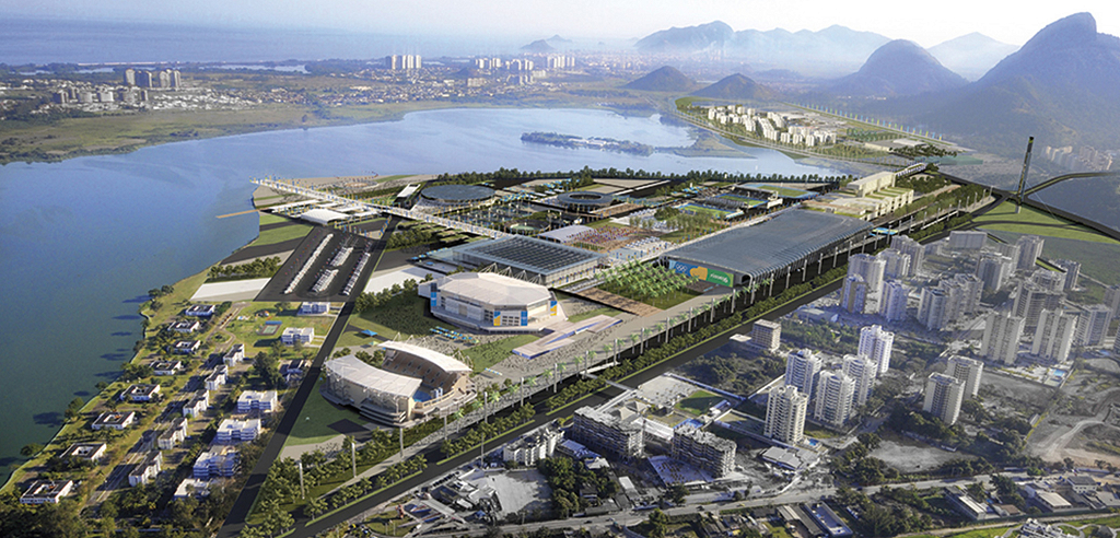
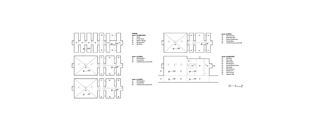
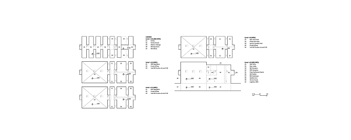
The core idea is a “Campus” organized on two main levels (0.00 and +6.00), structured by a circulation system formed by two long orthogonal pedestrian bridges, associated with a network of generous plazas and ramps. This system creates a sequence of suspended platforms extending across the entire site, connecting all venues through a concept of “3D Landscape Design.”
The ground level is reserved for the F.O.P. (fields of play, competition and training areas) and operational compounds. A second level, dedicated exclusively to pedestrian circulation and public support, is created through a system of two major perpendicular axes (North–South and East–West), each 40 meters wide, unfolding into ramps and suspended plazas that connect all the venues.
At this +6.00 m level, as visitors circulate through the suspended landscape, it is possible to obtain overall views of the F.O.P. areas below and a clearer perception of both the artificial and natural landscape, including the lagoon and surrounding mountains.
Beneath the landscape, additional program is accommodated. Below this suspended grid, the site is organized into two additional levels (with 3-meter floor-to-ceiling heights), allowing for spaces with greater heights or smaller subdivisions to house portions of the Games Overlay program adjacent to each venue. This strategy enables a complete separation between BOH service areas and FOH public areas, achieved through vertical sectioning rather than the conventional horizontal separation within each building.
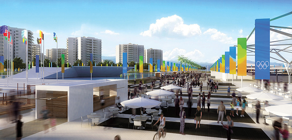
This apparently radical strategy of functional level separation proves to be an ideal solution for large-scale international sporting events, where the clear separation between public flows (FOH) and operational and accredited flows (BOH) is essential. The circulation grid and plazas thus form an immense pedestrian-only public realm — a true suspended urban landscape, fully integrated and free from vehicular and operational interference.
Beyond its functional advantages, this system of large public spaces also enables a continuous physical connection between all sports venues, without interruptions from road infrastructure. Rather than a collection of isolated architectural objects, the result is an Olympic Park designed as a single integrated entity, in which individual components are interconnected within a unified system extending across the entire site. The suspended landscape becomes usable space below as well, allowing for multiple programs and flexible uses — not only during the Games, but also as part of the post-Olympic legacy, combining functional efficiency with generous open public spaces.
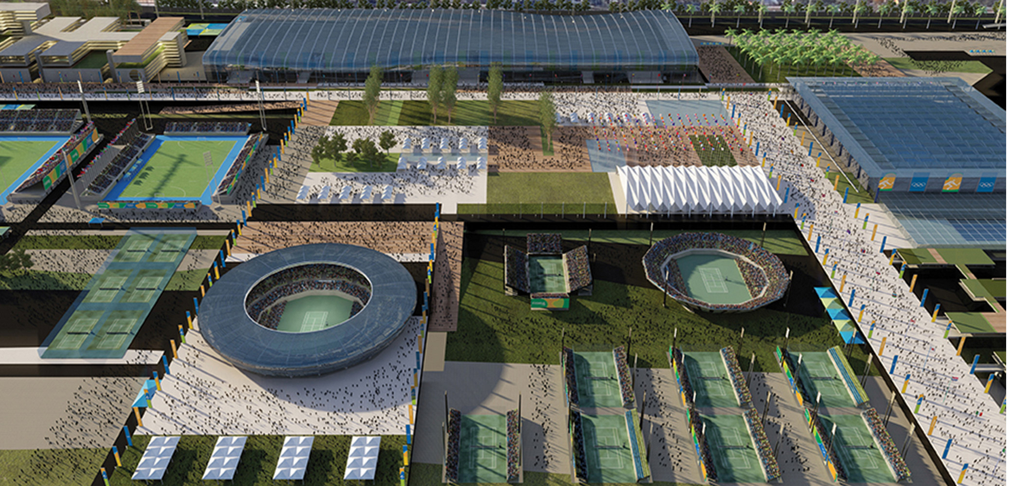
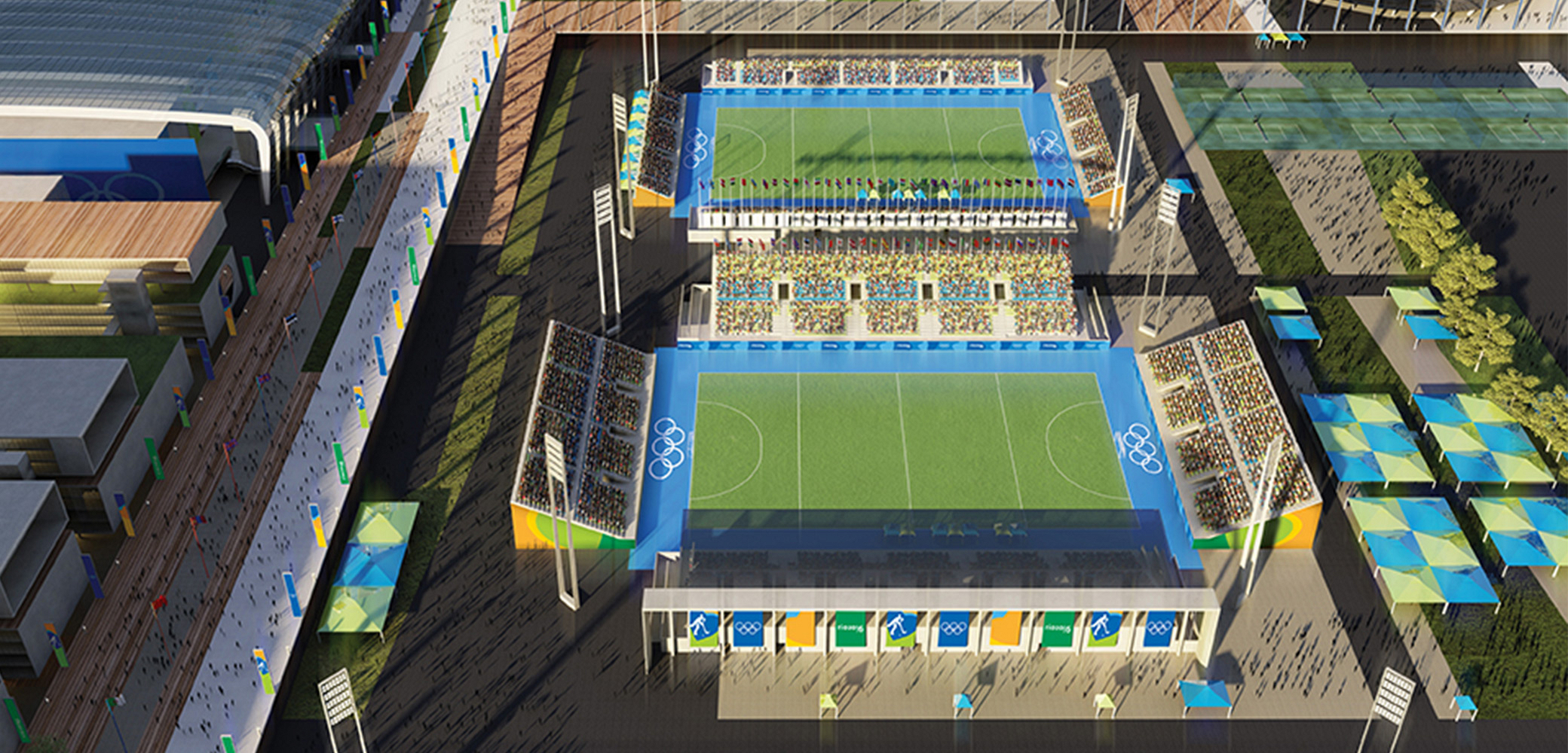
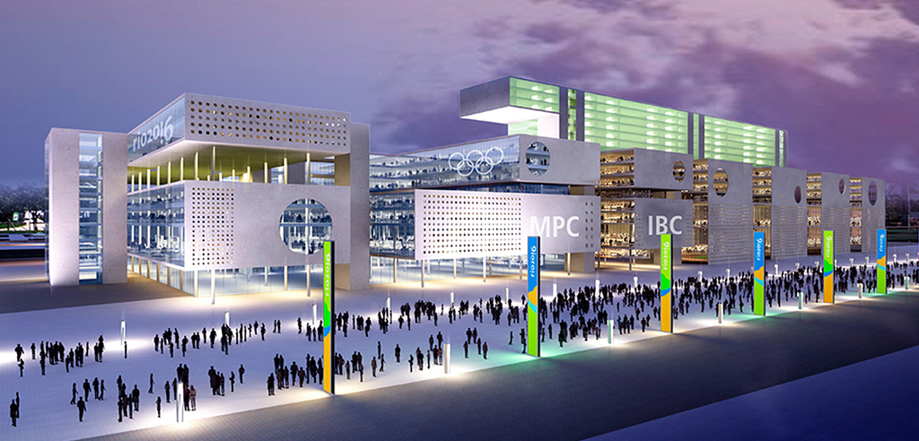
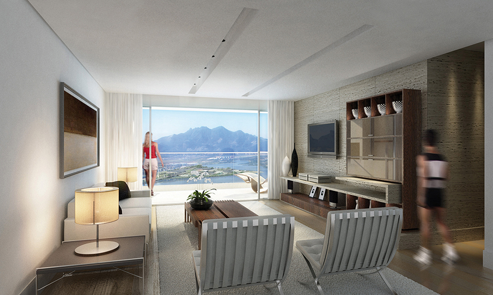
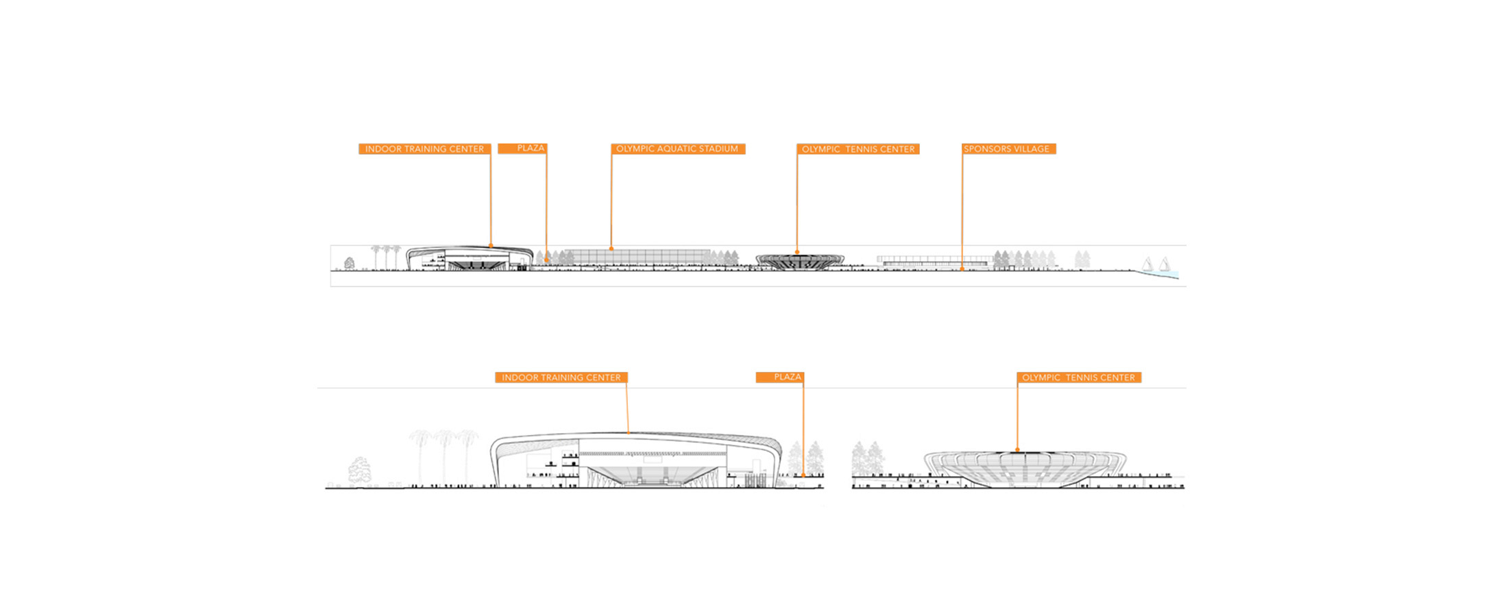
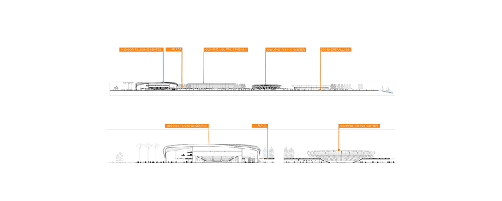
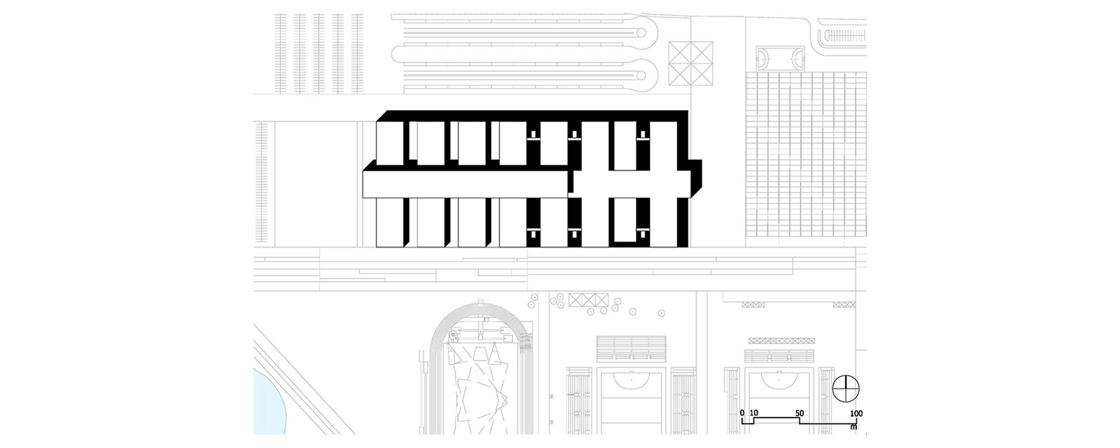
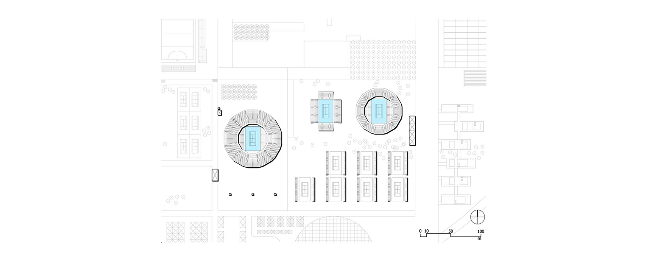
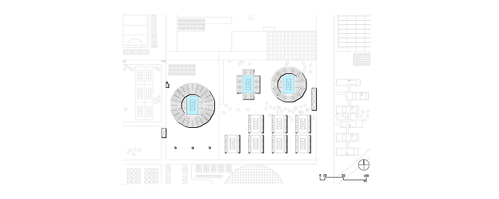
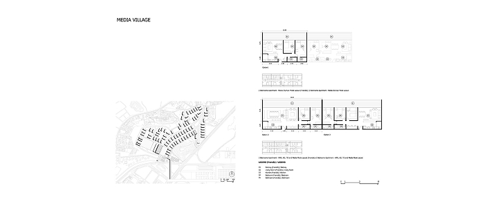
Public access is structured along the main perpendicular axes, to which the venues are “plugged in” and articulated. The East–West axis (40 m wide and 1,400 m long) begins parallel to the avenue at the Rio Centro BRT Terminal (CRC), crosses over the roadway, connects directly to the Media Village (MEV) via a pedestrian bridge, and runs longitudinally through the Olympic Park (OLP) between the IBC/MPC and the Hockey Center (HTC). It passes by the Indoor Training Center (ITC) and culminates in the monumental central plaza (340 x 200 m), the heart of the complex.
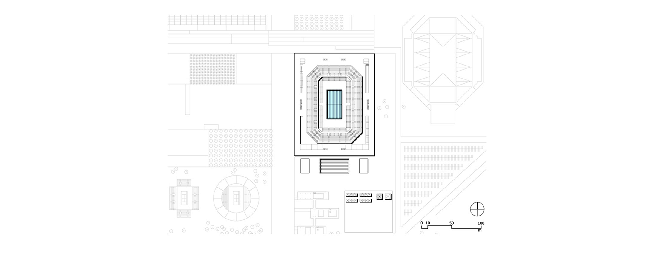
This great public esplanade serves as the main gathering space for visitors and offers a comprehensive view of all Olympic Park venues, articulating access to the ITC, Hockey (HTC), Aquatics (OAS), and Tennis (TTC) facilities, while also functioning as a stage for large crowds and events, supported by landscape-integrated infrastructure.
The North–South axis (40 m wide and 1,200 m long) begins at an inclined plaza with ramps perpendicular to Avenida Abelardo Bueno, skirts the central esplanade, passes alongside the Aquatics Center (OAS), connects to the athletes’ accommodations, articulates with the entrance plaza of the Velodrome (ROV), unfolds into a sequence of ramps and stairs to the lower levels, and extends between the Sponsors Village (SPV) and the Live Site, reaching the lagoon where it transforms into a wooden deck/pier.
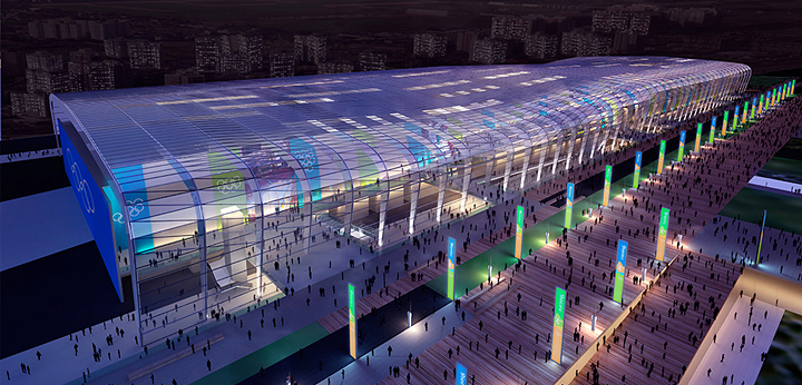
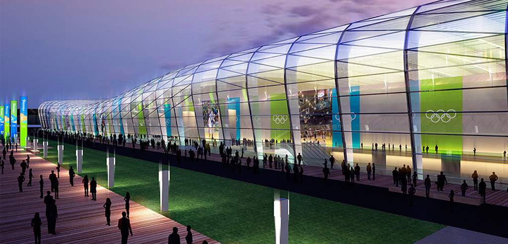
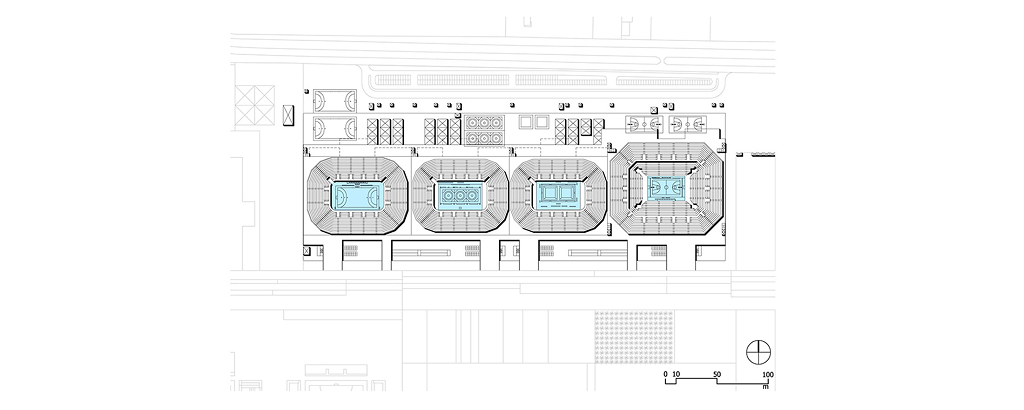
Within the Olympic Park (OLP), the architecture of each venue was treated individually, yet guided by shared principles: the use of clear geometric volumes, adapted to specific site conditions, and the extensive repetition of simple structural modules (5 x 5 m). This approach ensured a harmonious rhythm and proportional coherence among venues with distinct identities, as if they were all members of the same architectural “family.”
Project: Rio 2016 Bid
Conceptual Studies Application Rio 2016
Location: Rio de Janeiro, RJ
Year: 2008-2009
Architecture and Landscaping: BCMF Architects: Bruno Campos, Marcelo Fontes and Sílvio Todeschi (Architecture), with Carlos Teixeira (Landscaping)
Team: Patrícia Bueno, Leonardo Rodrigues, Mateus Hermeto, Carolina Eboli and Sean Mc Neary
Status: Project
Credits: Rio 2016 / BCMF Architects
Client: Application Committee RIO 2016
Management and General Coordination: Application Committee RIO 2016 / Alexandre Techima (Infrastructure Director), Elly Resende (General Manager), Ângela Ferreira (Architectural Planning Manager) and Rodrigo Garcia (Operational Planning Manager)
International Consultant: EKS/John Baker
Operational Masterplans and Temporary Installations Project: (Overlay) EKS/ John Baker and Rio 2016 Team (Ângela Ferreira, Ana Paula Loreto, Bárbara Fernandes, Flavia São Thiago, Izabela Hasek, Miguel Ciavarella and Patrícia Dias)
Graphic production: (BCMF Coordination)
Renderings: Casa Digital (Felipe Coutinho and team)
Final Art: Matiz (Fernando Coutinho and team)
3D Models: (Sketch-up) Equipe B – Fernando Pacheco do Nascimento e Leandro do Santos Magalhães and team (Fernanda Albert Saliba, Francielle Evelyn Mendes Gomes e Luisa Soares da Cunha Guimarães)
Computer Graphics: (Rio 2016 Coordination) André Maya Monteiro, Luiza Kramer and Daniel Bokelman
Models: Adhemir Fogassa Models