Urban Operation BH - The Arrudas River Urban Operation Consortium (Arrudas UOC)
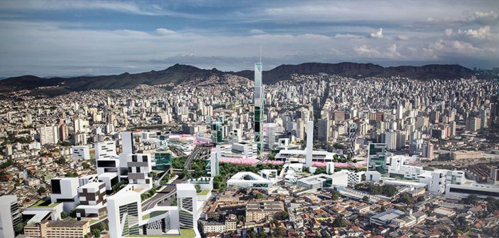
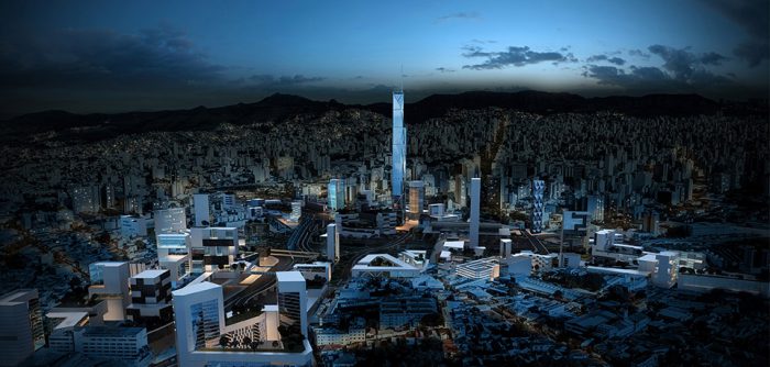
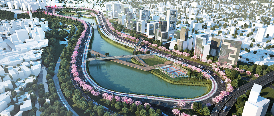
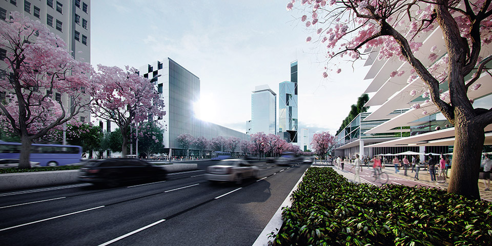
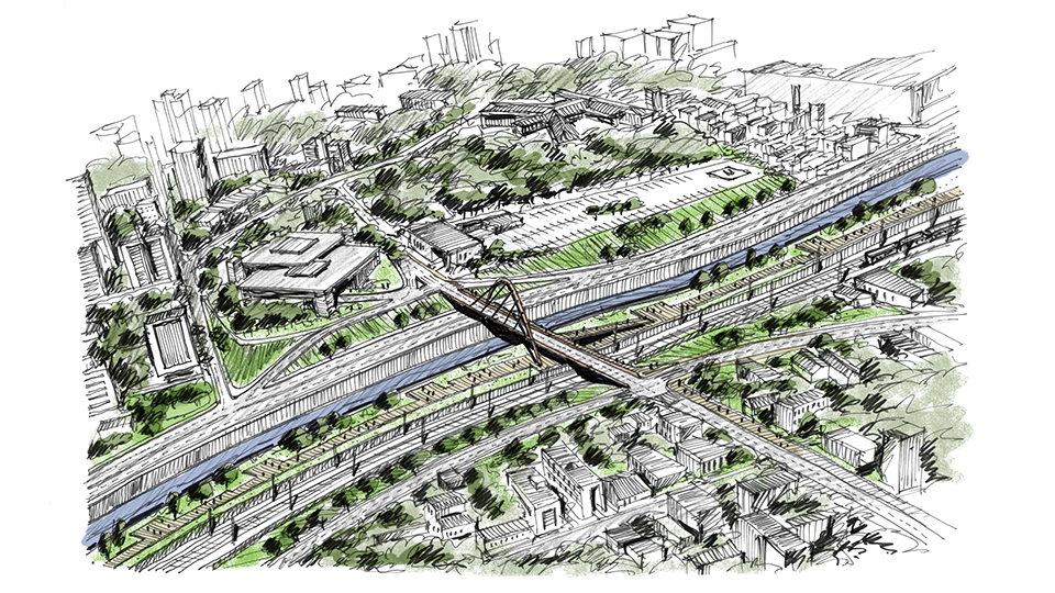
The Arrudas River Urban Operation Consortium was developed in 2013 by BCMF Aquitetos (in a partnership with AECOM, DG Arquitetura and Vazio S/A), as part of an Interest Manifestation Process led by the consortium of Andrade Gutierrez, Odebrecht and Barbosa Melo, for Belo Horizonte’s City Hall. It was intended to recover the river as part of Belo Horizonte’s landscape, to improve the connection between the northern and southern portions of the city and to develop new centralities, promoting urban densification through enhancements in the public transport system’s capacity and the creation of valued public spaces, in an urban layout designed for the pedestrian.
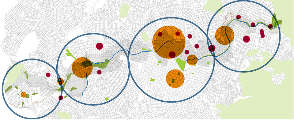
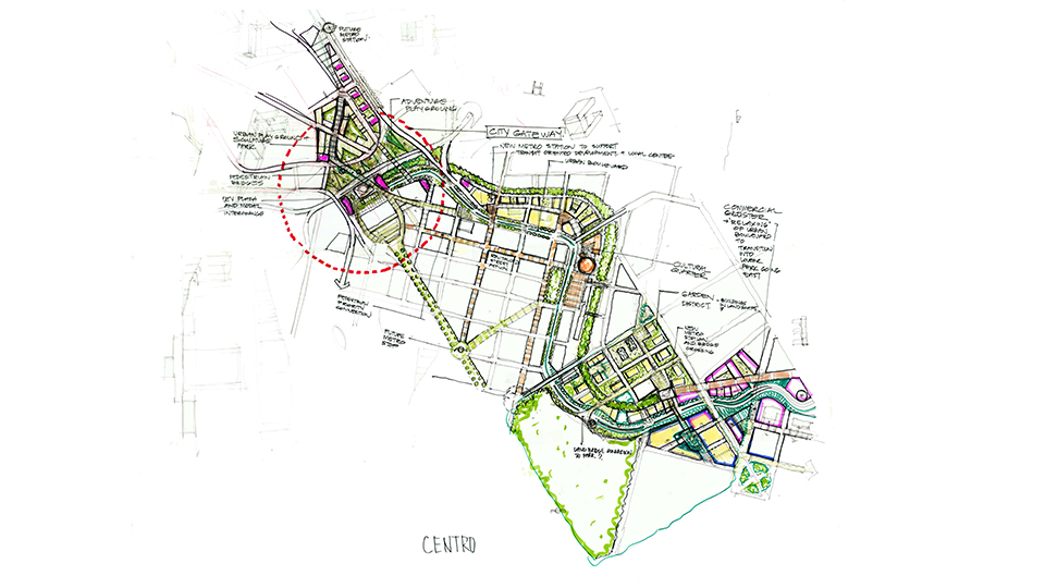
Initially, a study was conducted focusing mainly on certain regions: the Historical Center (67,54 acres), Lagoinha (70,33 acres), the Municipal Park/Floresta neighborhood (94,93 acres, Boulevard Arrudas / Santa Tereza (112,39 acres) and Barro Preto (137,13 acres).
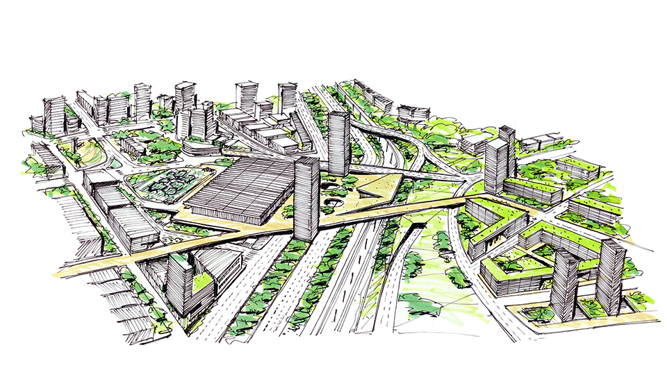
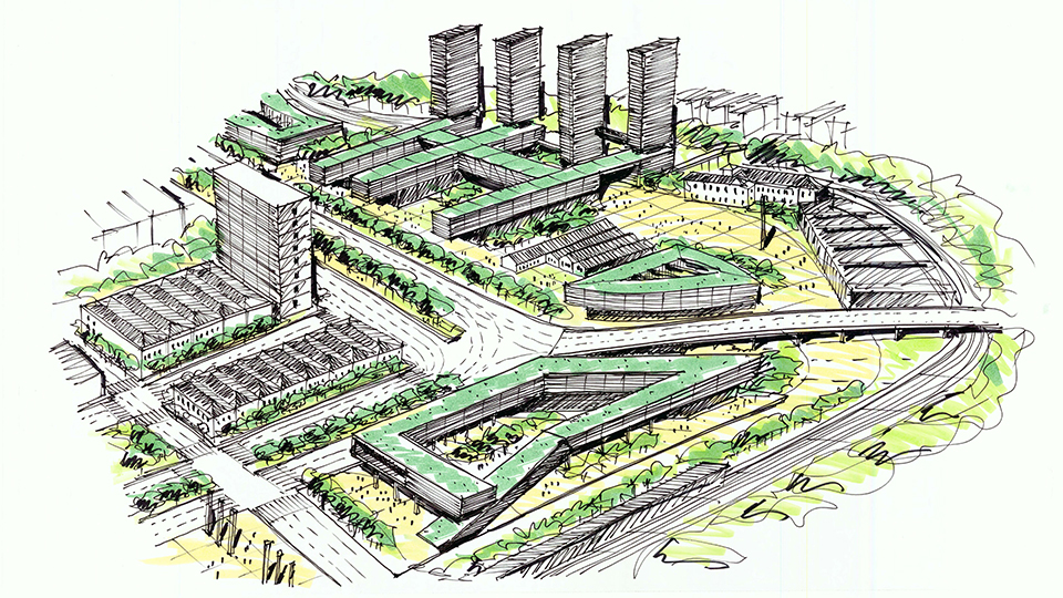
Later, studies were broadened to five macro-regions: Parque Bacia do Calafate (312,08 acres), which consists of the neighborhoods of Gameleira, Coração Eucarístico and Nova Suíssa; Boulevard Oeste (253,93 acres), which consists of the city center’s western region, and the neighborhoods of Calafate, Carlos Prates and Prado; Central (505,06 acres), which consists of the City Center itself; Lagoinha (48,48 acres); Parque Linear Leste (279,73 acres), which consists of the area following along Andradas Venue, Contorno Avenue and Ituiutaba Street.
Several workshops and diagnostics were conducted by the multidisciplinary team together with Belo Horizonte’s City Hall, to draft suggestions of parameters for the use and occupation of the soil & typologies (settlement models), including a complete mapping of the aforementioned regions and Mass Studies of all the macro-regions, besides the Mapping for Social Housing Implementation.
Furthermore, the following studies were also conducted as a preliminary study:
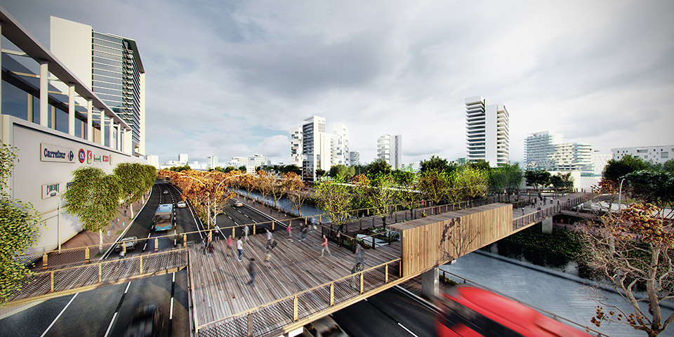
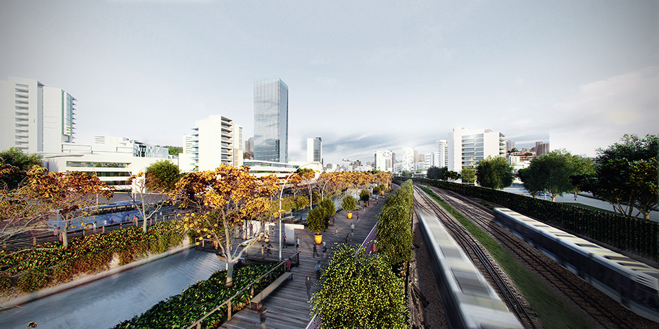
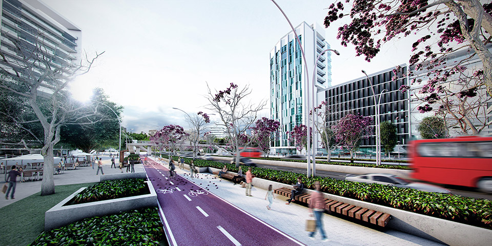
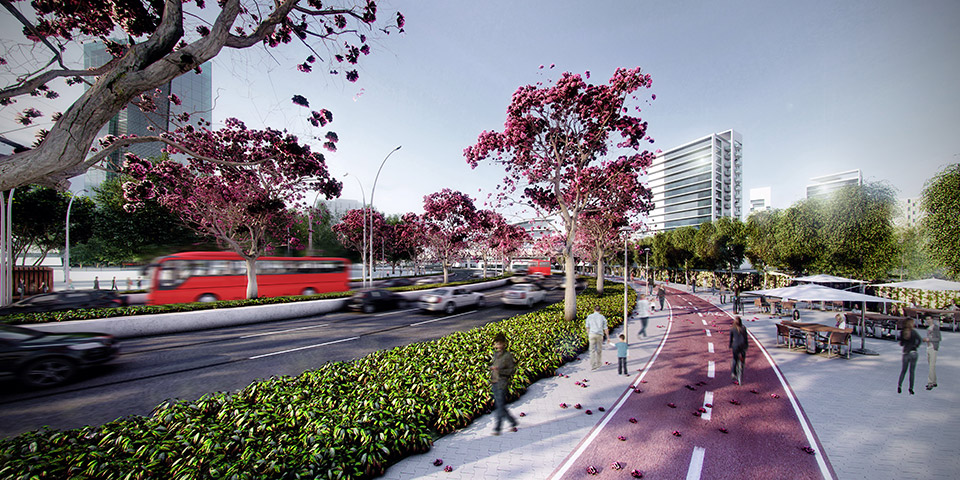
– Urban Mobility Studies (Hierarchy and Road Classification Studies; Bike Lane Implementation Studies; Preliminary Architecture Studies of Works of Art, mappings of all the interventions and their implantation priorities);
– Environmental Studies;
– Architecture and Landscaping Studies for Plazas and Public Parks, in a total area of 69,95 acres;
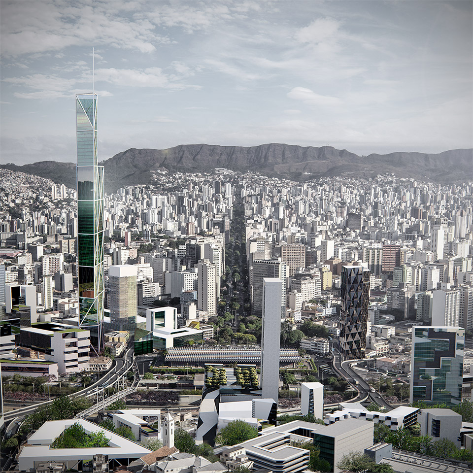
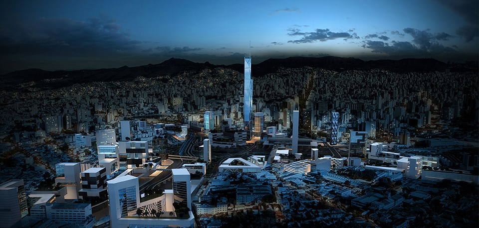
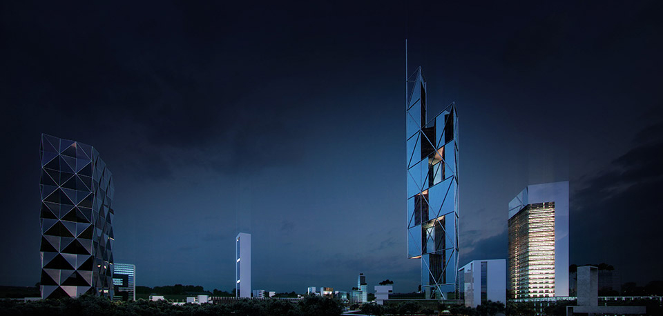
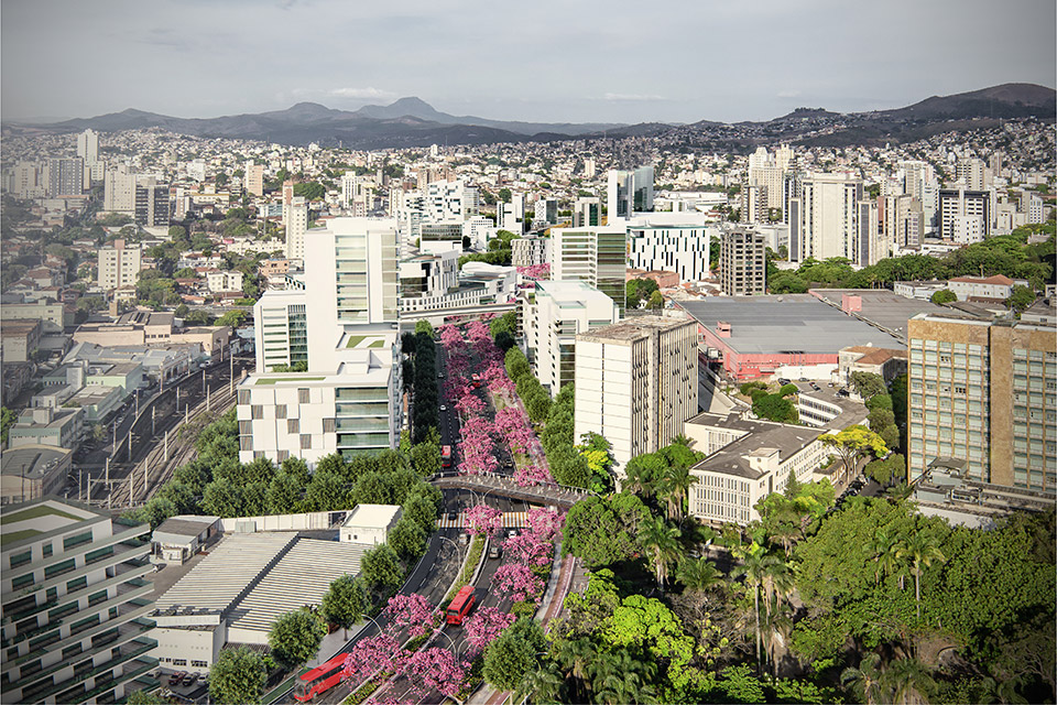
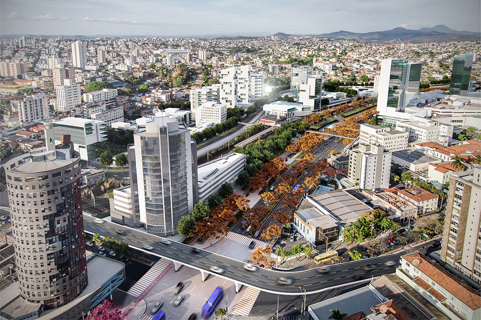
– 3D IMAGES of all of the sectors of the Arrudas UOC (including comparative studies of the existing conditions and the proposed intervention);
– Geoprocessing (ArcGis): project data transformation (MASTERPLAN / URBAN PLAN) for the elaboration of maps in a shape file form, ArcGis, including the setting of parameters from the database that include informations on mobility, envinronment, use and occupation, dwelling, equipment, historical heritage, zoning and sociodemographic data of all of the sectors of the Arrudas River Urban Operation Consortium.